Monitoring Flooding in Pakistan Using ALOS PALSAR Data Provided by JAXA
Brief Summary of Pakistan Flooding Monitoring (![]() , CEOP-Vol.20_No.3_07-p08.pdf ) [0.4MB]
, CEOP-Vol.20_No.3_07-p08.pdf ) [0.4MB]
PALSAR Images:
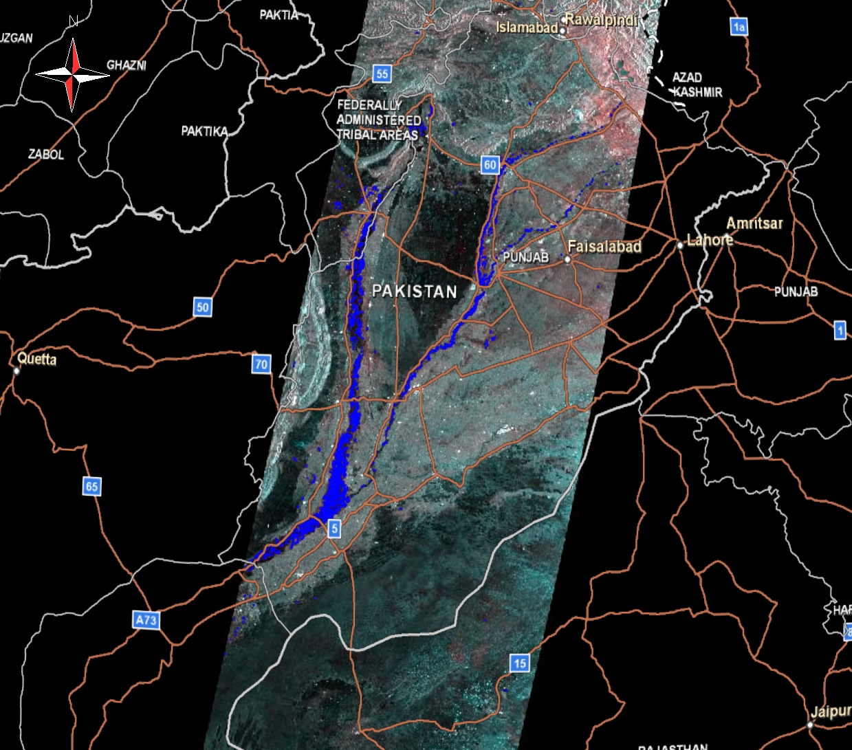
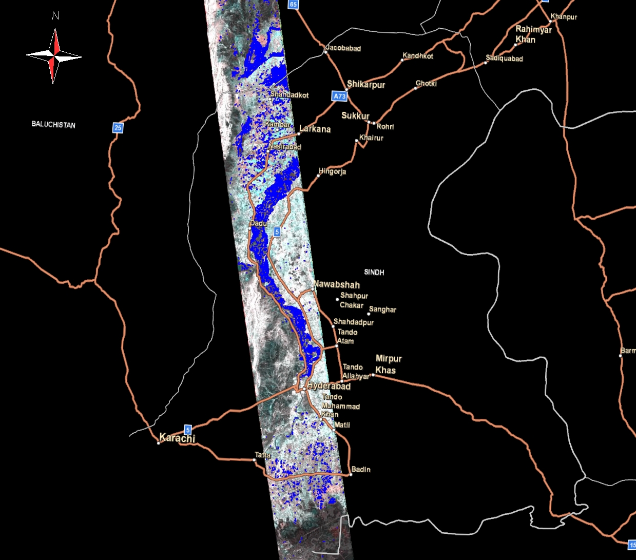
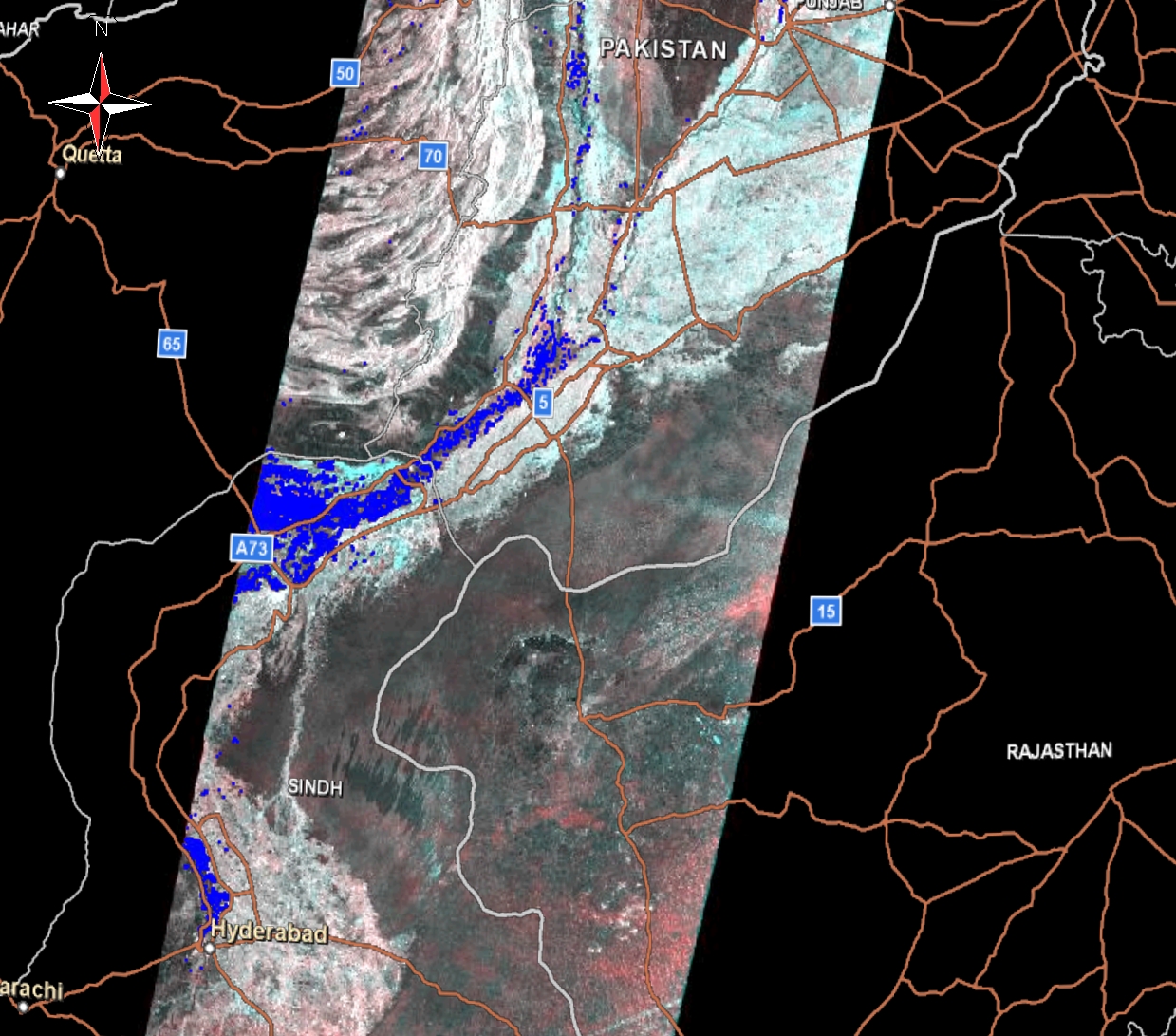
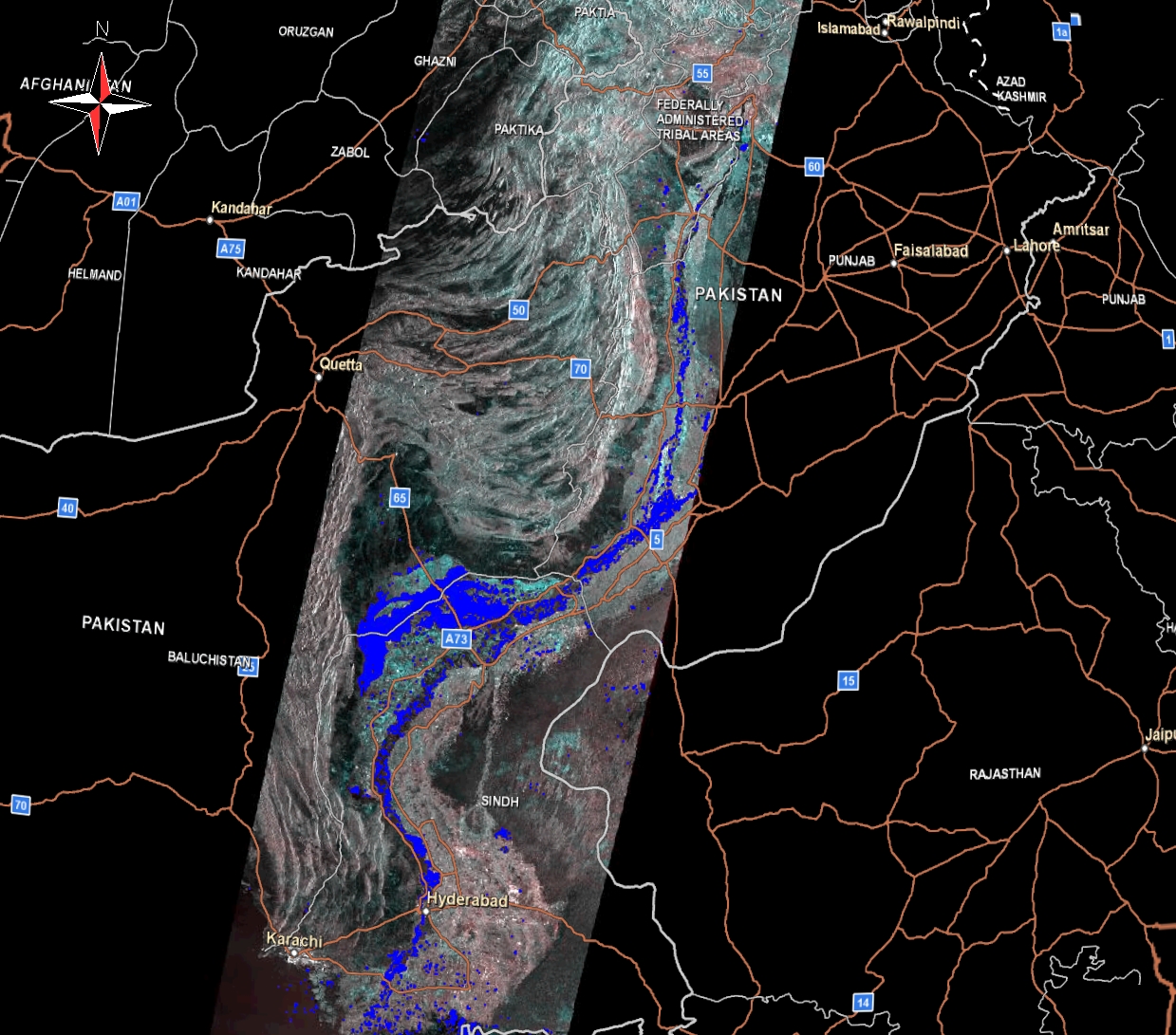
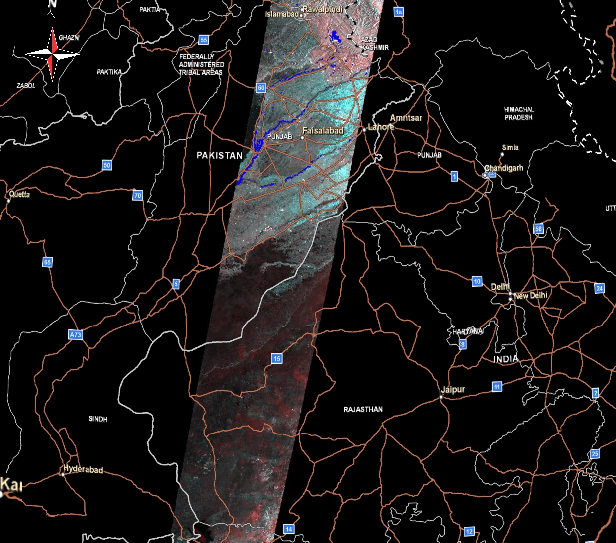
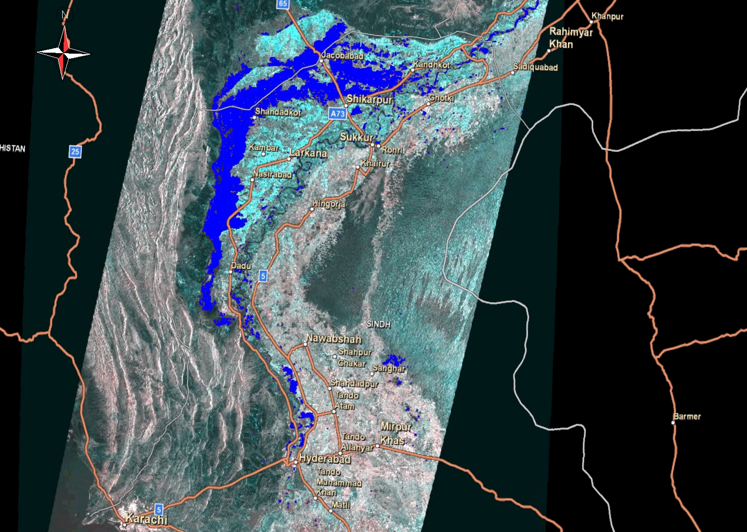
| PALSAR_Flood + Road (Please click left mouse then high resolution image appear in new window. Please click right mouse button there and select "save image as" to save high resolution image.) |
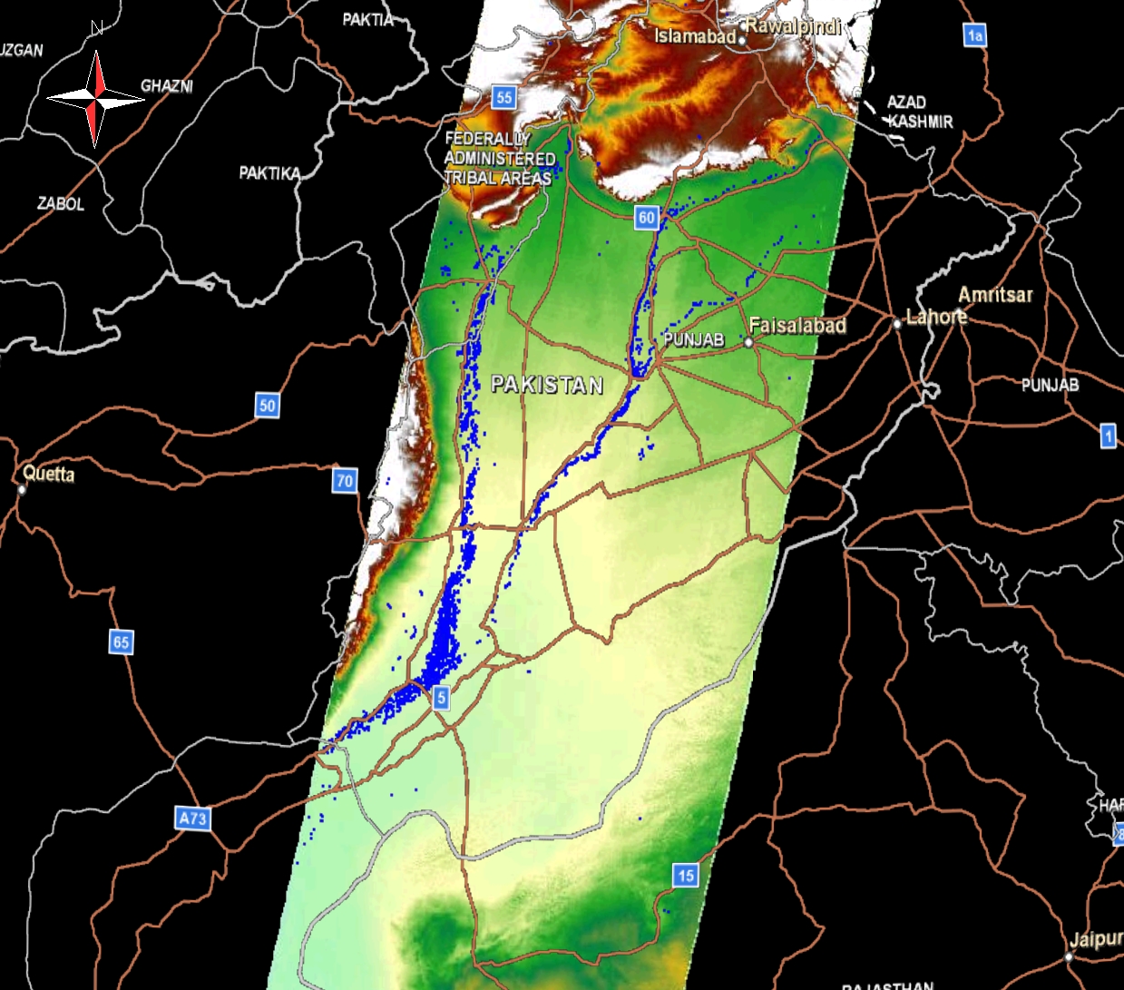
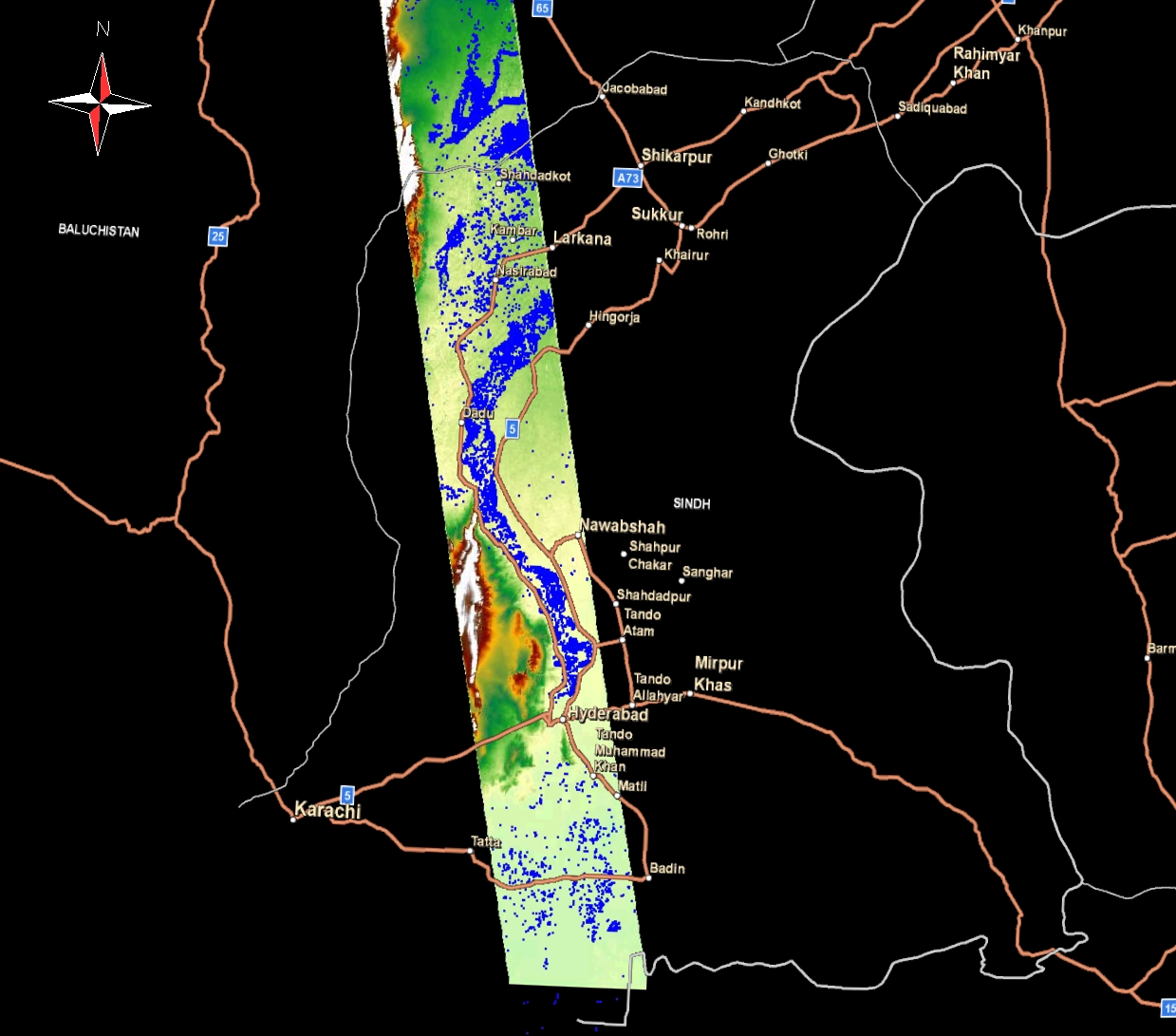
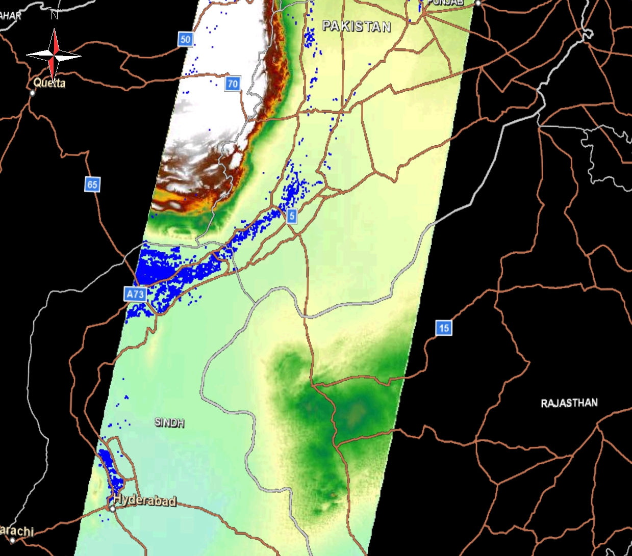
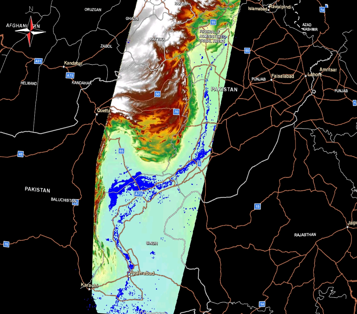
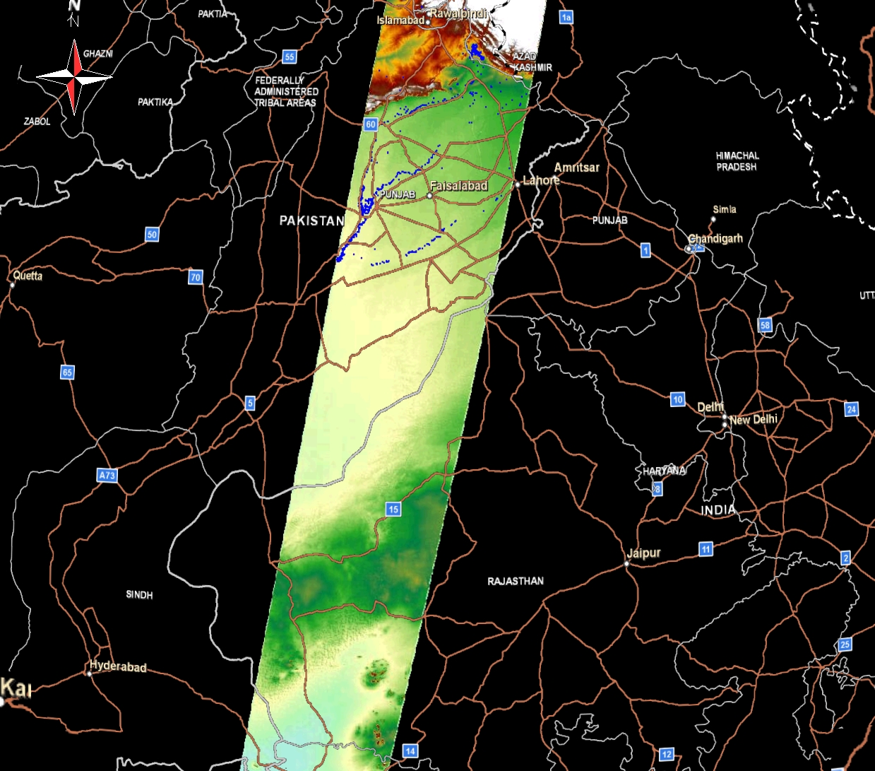
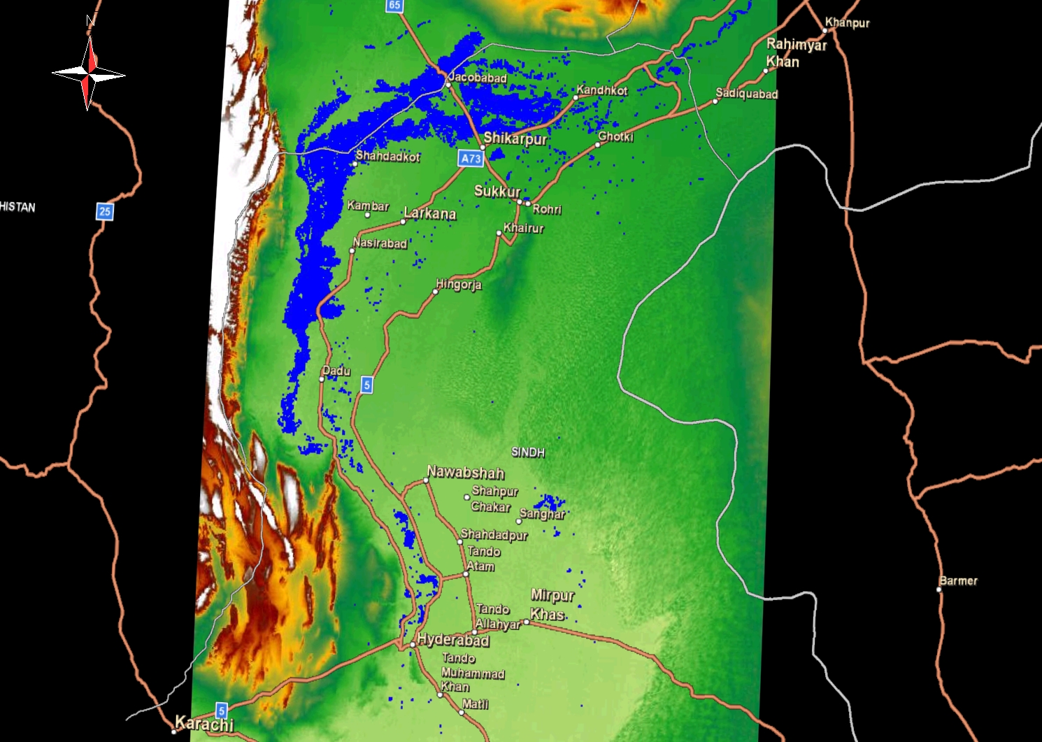
GDEM + PALSAR_Flood + Road (Please click left mouse then high resolution image appear in new window. Please click right mouse button there and select "save image as" to save high resolution image.) |
On the Google Earth (Please click "open" when you asked on you computer). Or please download "kmz" file on your computer then double click it. You can see the flood area on the google earth.) |
|
| 2010/08/05 (Thu.) |
 |
 |
|
| 2010/08/19 (Thu.) |
 |
 |
|
| 2010/08/22 (Sun.) |
 |
 |
|
| 2010/08/27 (Fri.) |
 |
 |
|
| 2010/08/29 (Sat.) |
 |
 |
|
| 2010/09/13 (Mon.) |
 |
 |
|
ALOS data through the Sentinel Asia
JAXA's analysis on the extent of flood:
Observation of the
concentrated heavy rain in Pakistan using PALSAR onboard "Daichi" (ALOS)
Observation of the concentrated heavy rain
in Pakistan using PALSAR onboard "Daichi" (ALOS) [in Japanese]
Observation of concentrated heavy rain in Pakistan by AVNIR-2 onboard "Daichi" (ALOS)
Copyright : The University of Tokyo (UT) and Japan Aerospace Exploration Agency (JAXA)
DISCLAIMER
Last updated 2010/10/14 14:46:40 +0900